| Photojournal
- 1 March 2008
Heading for The Hills
In early February I had realized that I was out of candle, as I had been burning it at both ends for way too long. Stress at my day job had been getting to me, and my health was suffering. So I did the sensible thing, which was to schedule a vacation at the earliest time possible.
So on the morning of the first of March I left home, heading for The Hills. The Hills, or less briefly, The Hills Health Ranch, is a spa, retreat, and recreation resort in the Cariboo region of British Columbia, at 108-Mile. 108-Mile is, appropriately enough, about 8 miles past 100-Mile House. With good weather, and without stopping, that's about a 5-hour drive from where I live in New Westminster.
I had my car trunk loaded with stuff for a two-week stay, and my best camera by my side in the passenger seat. I wasn't due to check in at The Hills until the 2nd, but I was leaving on the 1st so that I could pursue any photographic opportunities that presented themselves without worrying about having to get up to 108-Mile by driving at night on icy mountain roads. The parts I was to be passing through are known for Bighorn Sheep and Elk, and if I found any of those, it wouldn't be beyond me to spend all the daylight hours tracking and photographing them.
The areas known for such big game are in the Fraser Canyon, and to get there, I first had to pass through the Fraser Valley, which was about a two-hour drive. I only stopped twice in this stretch: once for breakfast, and the other time when I spotted a flock of Trumpeter Swans in a field near Chilliwack. |
|
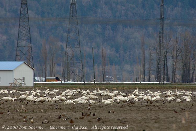 |
There's a possibility that there were Tundra Swans in that flock as well, but in the quick scan I did through my binoculars, none popped out at me.
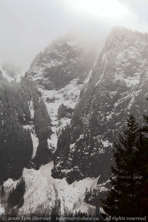
The town about where the Fraser Valley turns into the Fraser Canyon goes by the name of Hope. At Hope I had two choices: I could take the big modern four-lane Coquihalla Highway, which heads up through the mountains, or the old two-lane Trans-Canada Highway, which winds along the Fraser River. I took the Trans-Canada, because it's a prettier drive. A few kilometres after getting on the Trans-Canada at Hope, I stopped to take photos of the mountains, which were draped in snow and topped by clouds. |
|
 |
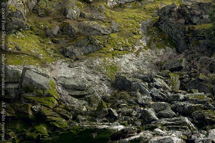
| At the same stop, I pointed my camera the other direction and got some shots of sunlight on wet rocks and moss. |
|
 |
| About twenty minutes later, I was leaving the frosty-looking mountains and getting to some that had snow only in patches. I stopped when a big hole in the cloud cover created a rainbow beside the road. |
|
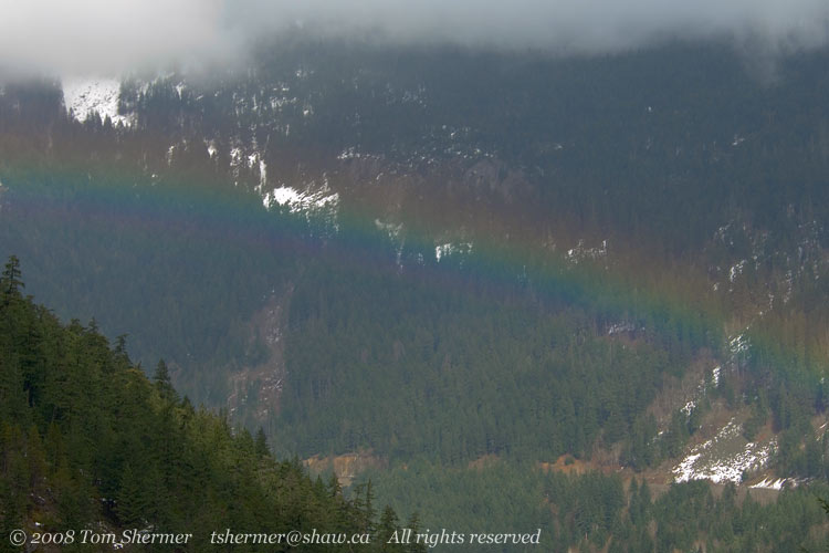 |
I enjoyed that sight for a while; it's not often that I get to look down on a rainbow.
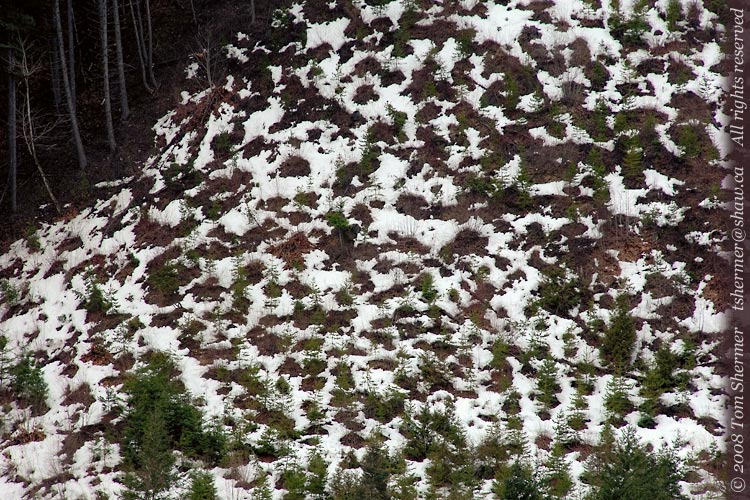
Another twenty minutes later, near Boston Bar, I found some hillsides with an interesting mottling of snow on them. I couldn't resist the colors and pattern. |
|
 |
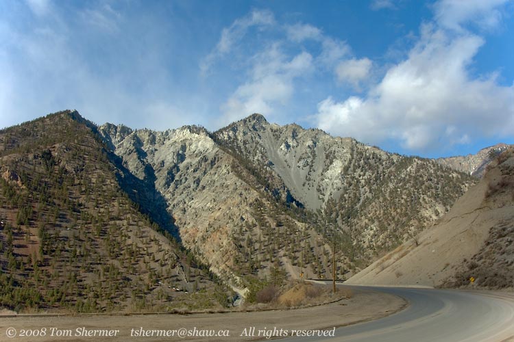
| My next few stops were around Spence's Bridge, which is an area known for Bighorn Sheep. I stopped to scan the mountains for these beasts, but I didn't find any. I took a few more landscape photos as a consolation prize. |
|
 |
| Here's another shot from near Spence's Bridge; this is the sort of cliff that I'd like to find sheep on. That'd make for good photos. |
|
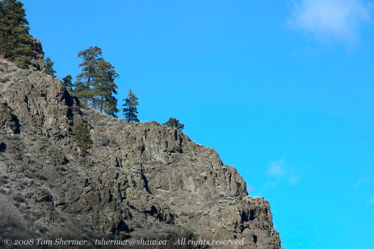 |
That is, it'd make for good photos if I were to climb up there to get close enough to get good shots.
I was slightly relieved that I saw no sheep and had no climbing to do. But only slightly.
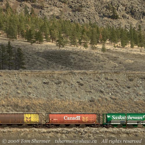
I continued my drive northward, eventually coming to a halt somewhere near Cache Creek. A worker was holding up traffic while road crews were removing some rockslide debris from the road ahead. In these parts, they have a lot of signs warning about falling rock, and it's not just theoretical falling rock that they're referring to. It's actual rock that falls. Or rolls, or slides.
We had about ten minutes to wait, so I turned off my car and took some photos. There were train tracks on the other side of the river, with a train sitting there on them. I liked the colored grain cars, so I took some photos of them. I particularly liked this one, which showed a few cars and the trees on the slope above them.
|
|
 |
| I even had enough time to get out my fisheye lens. This shot shows the cars stopped in front of me, the river, and the train on the left. |
|
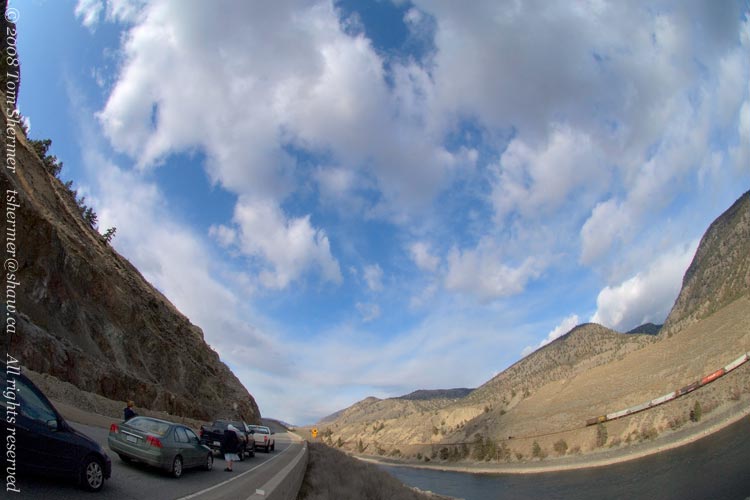 |
It also shows that there was a nun in the car in front of mine. I hope it's not sacreligious to take a fisheye photo with a nun in it. (In a twist of linguistic serendipity, the word nun has a relatively obscure alternate meaning of "a pigeon of a particular breed that has a crest on its neck"...so maybe the above is a strangely symbolic bird photo.)
I didn't have time to really ponder that, though, as soon the nun was on her way again, and I was, too. We were both zooming along, headed towards Cache Creek. I found myself in a race with the nun and her driver along a winding rural highway. We jostled for position a few times, but I wasn't ever able to pass; it was like they had some extra unseen force on their side that held me back. So eventually the nun won our race, making it to Cache Creek right before I did.
At Cache Creek, the Trans-Canada Highway turned eastward towards Kamloops, taking the nun along with it. I bade my adieus, as my route was northward along Highway 97.
On 97, I found my first circling raptor of the day. I could tell before stopping that it was an eagle, but it was only after taking a good look that I saw it was a Golden Eagle, not a Bald Eagle.
He was far away and I didn't get a clear photo, but from the general coloration and outline, this is clearly a Golden. Bald adults have straighter wings, and Bald subadults don't have this color pattern. |
|
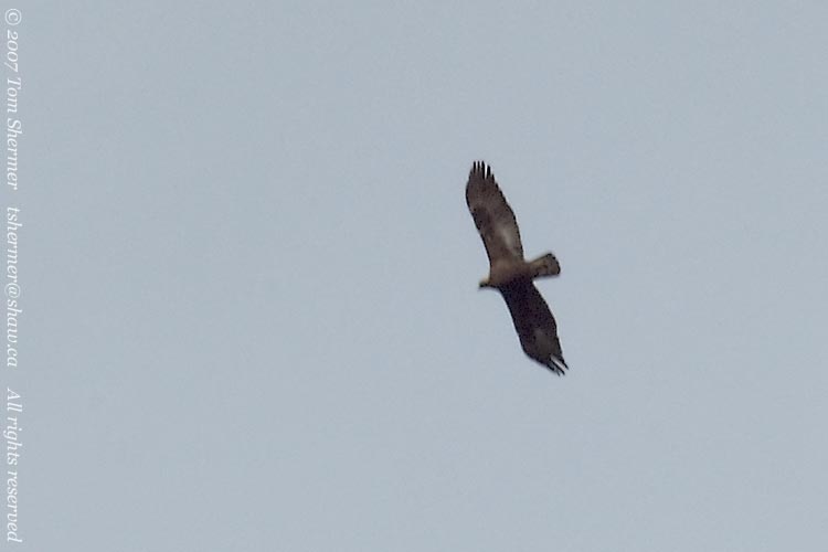 |
Our other big raptor that looks vaguely like this is the Turkey Vulture, but it has a smaller head and is more black than brown.
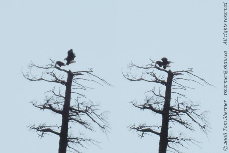
That was a neat little sighting. After that, I saw several more eagles, but they were all Bald Eagles. I was surprised when I watched one descend into a tree right where another had landed. I expected the first to move out of the way as the second came in (a common occurance—one eagle "bumping" another to a different branch), but the first eagle just stayed there. It turned out it was time to start making more eagles.
|
|
 |
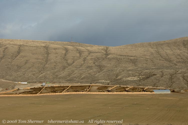
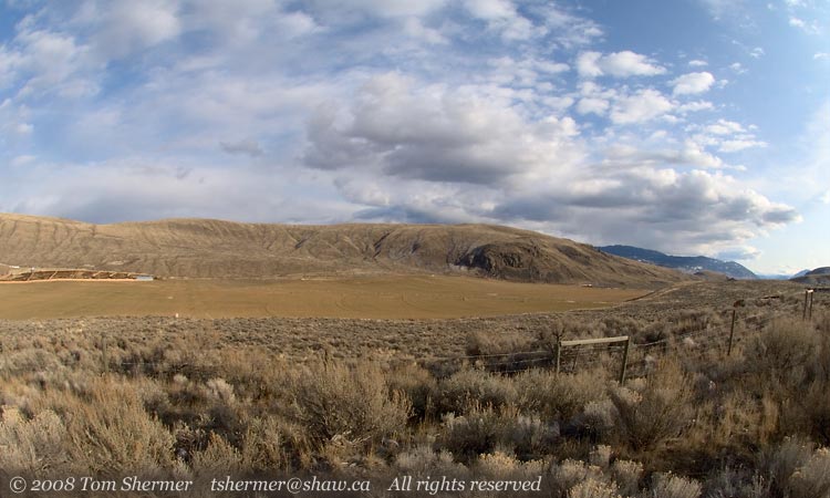
I left the eagles to their business and drove northward some more. Sometime before the town of Clinton, I looked to my right and found a valley with large fields and some cattleyards. I was attracted by the colors of the whole arrangement, so I pulled over to take photos.
I tried several different treatments. Here's one showing most of the yards, along with the field in front and hills behind. |
|
 |
| And here's a fisheye view from the same place, which exaggerates the sage and scrub desert in the foreground. Fisheye (and wide-angle shots in general) tend to do that...they make the foreground feel more important and the background less so. |
|
 |
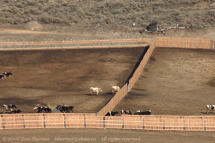
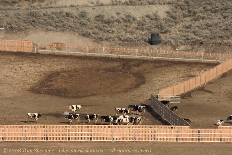
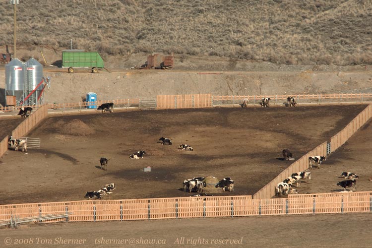
| The shots from this vantage that I ended up liking the most, though, were telephoto shots of the cattle in the yards. The colors and textures just seemed to all work together very well. Here's three of them. |
|
 |
| |
|
 |
| |
|
 |
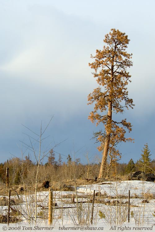
| After about forty minutes more driving, it was around 4:30, and I was near a little town called Chasm. The sun had started to get fairly low and it was providing some dramatic sidelighting. I stopped to take a photo of a lone Ponderosa Pine that was getting this treatment. |
|
 |
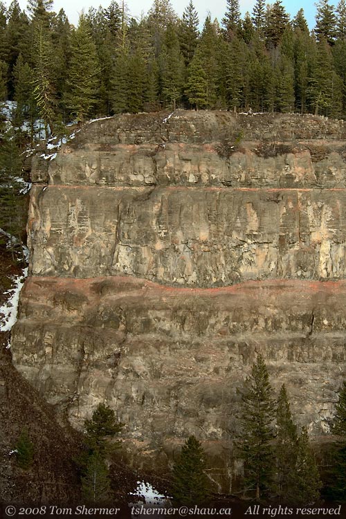
Chasm is named after a "painted" chasm, which is a rift whose cliffs show pretty red layers of rock that were deposited by volcanic activity. I'd read about this effect, but hadn't stopped to have a look in the two times I'd passed the town before. I wasn't in a hurry this time, so I decided to take the detour to the viewpoint.
I had to tread carefully when I got there, as the ground was covered in ice and snow, I had only running shoes (not my waterproof hiking boots) on. When I finally got to the fence to look over the nearest cliffs, I found that the sun had already set on them. That turned out to be okay, though, as the indirect lighting brought out some good detail. |
|
 |
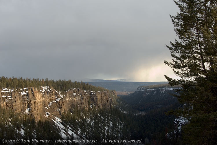
| About twenty meters and several minutes away, I found another place where I could look out southward and get a view of the whole gorge. |
|
 |
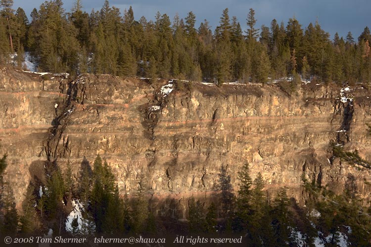
| From there, I also found some nearby cliffs where the sun hadn't set. The yellowy evening sunlight gave them a quite different feel than the indirectly-lit cliff of two photos ago. |
|
 |
As I left Chasm, the light was getting a bit too dim for decent photos. Since Chasm is around 65-Mile, I decided that I may as well not stop for the night until I made it to100-Mile House. About 45 minutes later, I was ensconced in a motel room in that town, reading a novel.
The next day, I would drive around the area, looking for photo subjects, before checking into The Hills in the afternoon. That day's finds will be the subject of my next entry.
Second to nun,
Tom
|
|
|