| Photojournal
- 22 August 2006
No Elk Falls
On Tuesday I woke up in a motel in Qualicum Beach. I got up early, because I was on vacation, and I wanted to see if I could get any good sunrise photos. I collected my camera gear and walked across the street to the beach as it was getting light. It was 6:40.
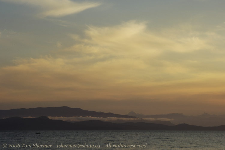
Normally, if I'm up at that hour, I'm pretty groggy, but there was a chill in the air that kept most of that at bay. The colors of the morning were subdued, somewhat like the sunset the day before. |
|
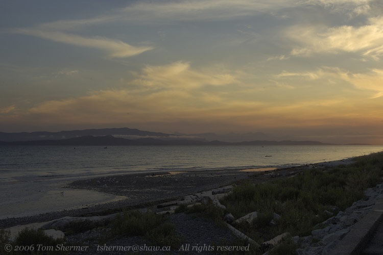 |
The only birds around (like the one wading on the left in the above photo) were gulls. They occasionally called, and their sound, along with the waves lapping up on the beach, was pretty neat...a nice thing to wake up to.
Unfortunately, the eastern horizon was cloudy, and so the landscape just gradually brightened, giving me pastels rather than a vivid orb on the rise. Here's a shot from a few minutes later, zoomed in on the middle-left region of the one above. |
|
 |
I had my general-purpose lens on the camera, as it seemed to have the right magnification range. My wide-angle was too wide, and the telephoto zoom is more for small subjects.
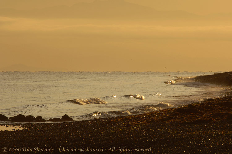
I got some coffee at the service station next to my motel and came back to find a broad swath of orange in the sky. That orange color reflecting off the blue water made for an interesting contrast. |
|
 |
I tried getting some photos of a few houses along the beach, and of the mountains to my west, but I couldn't find any compositions or colors that really excited me and so the photos I did take turned out unsurprisingly dull.
After about 45 minutes the sun had risen to the point where the good colors were mostly gone, and I started to get sleepy, so I went back to my room and slept for a while.
On reawakening, I had breakfast, checked out, and headed north along the old road. There's a new highway, a much wider, straighter, faster road, a little inland, but it just isn't anywhere near as scenic as the old road, which winds around along the shore. Taking the old route, in the late morning I found myself driving up to a place where a weatherbeaten old boat sat upon the shore. I had to stop and get photos. |
|
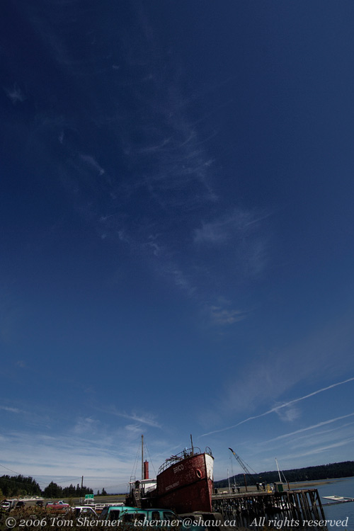 |
| The boat, apparently, was the Brico. At some point, someone had opened up a restaurant in the grounded boat. (I was able to deduce this from the fact that the word "restaurant" was painted on her.) |
|
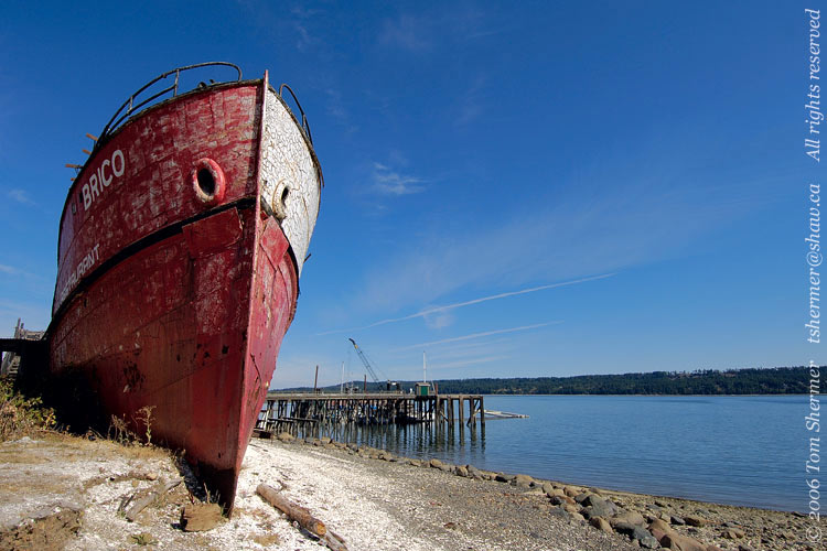 |
When I poked around her, though, I found that the entrance to the restaurant was boarded up and had a "no trespassing" sign on it. Not very welcoming for your customers, if you ask me.
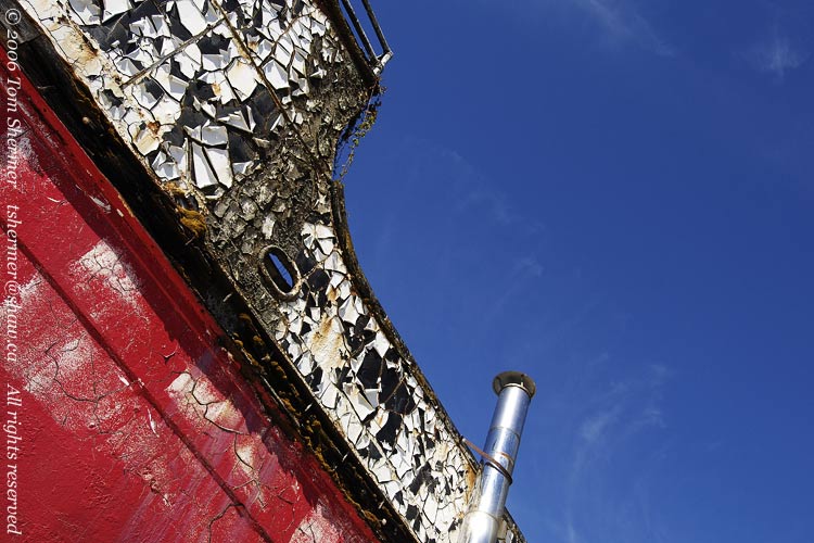
The port side of the boat, which faced the water, had a luscious coat of cracked and peeling paint, and I really wished I had a ladder with me so that I could have gotten some straight-on photos of it. I had to settle for what I could do, which was wide-angle shots from nearby and below it all. |
|
 |
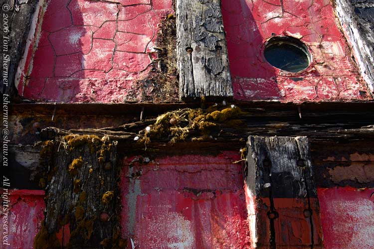
| Here's some detail that was a little lower and more accessible. |
|
 |
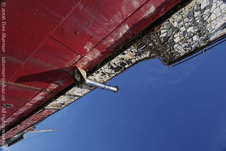
| And here's a final shot of the Brico. This shot came out of the camera in this orientation, and it's much better this way than if I rotate it. If I rotated it, it would be too boring to show you. |
|
 |
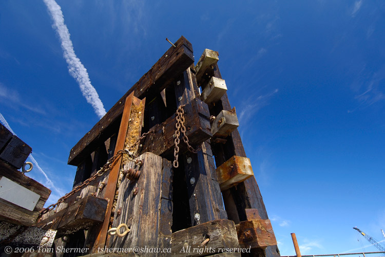
| I walked along the rocky beach a very short ways, and came upon what looks to be a marine bumper of some sort. I've seen larger versions of these sorts of things at ferry docks, to hold the ferries in place. It took some moving around and stepping on algae-coated things to achieve the dramatic perspective and to get the contrail in the right spot in this shot. |
|
 |
I found a sign that informed me that I was at a place called Fanny Bay. I walked out on a pier but found no good photos there. It was a nice day, though, so I sat down on the part of my anatomy that seemed appropriate to the place to enjoy the sights and sounds and smells.
After a bit of that, I wandered back down the shore to a couple of barges that had big stacks of black plastic boxes on them. |
|
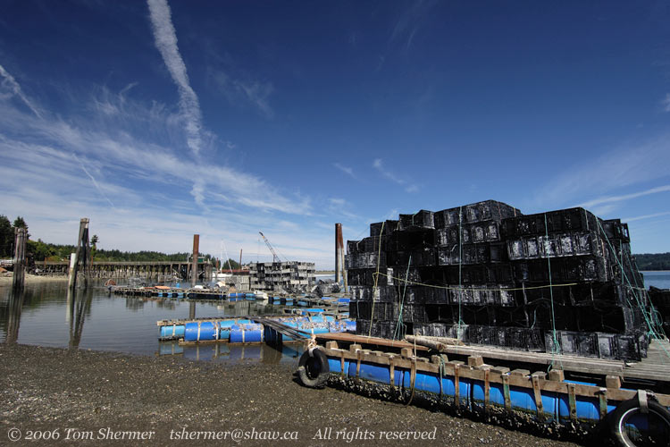 |
In my subsequent researches, I've discovered that Fanny Bay is a well-known oyster production locale, so maybe the black boxes were oyster traps. You could take these traps out and drop them in the water, and all the oysters would crawl around and jump in them. Then you pull 'em up.
Okay, well, it's probably more likely they're crab pots. Oysters don't really crawl around all that much, but crabs do.
I headed back towards my car. On the way, I encountered a half-meter-or-so dropoff that I would have to mount. The dropoff was interesting in that it revealed that the land above was composed of a thick layer of (oyster, I presume) shells. |
|
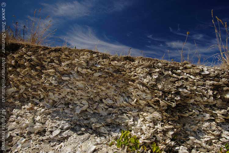 |
I wondered how far inland the layer of shells went, and thought briefly of coming back to the area with a shovel one day. That thought was closely followed by visions of being chased out of town by people who didn't take kindly to me digging holes on their property.
So after taking a few shots of the shelf of shells, I headed on.
I drove for a while, passing through Courtenay and eventually stopping around 1 o'clock in Campbell River, where I picked up some groceries and had lunch at a place that specialized in goulash. Gotta love a good goulash.
After lunch I started going north again, but almost immediately my curiousity was roused by a sign that indicated that I should turn left if I was headed for Elk Falls Provincial Park. Since I was hoping to see elk on my trip, I thought that this might be a good opportunity, so I turned.
Soon I came upon the turnoff for the campground, but the falls themselves were farther along. After a wrong turn that got me to an electric generating plant, I eventually made it to a gloomy parking lot somewhere in the woods. Following a path down from there, I made it to a lookout on the side of the falls. |
|
 |
| It was cliffs all around at this point, so, short of rappelling, I wasn't getting any photos from the bottom of the falls. |
|
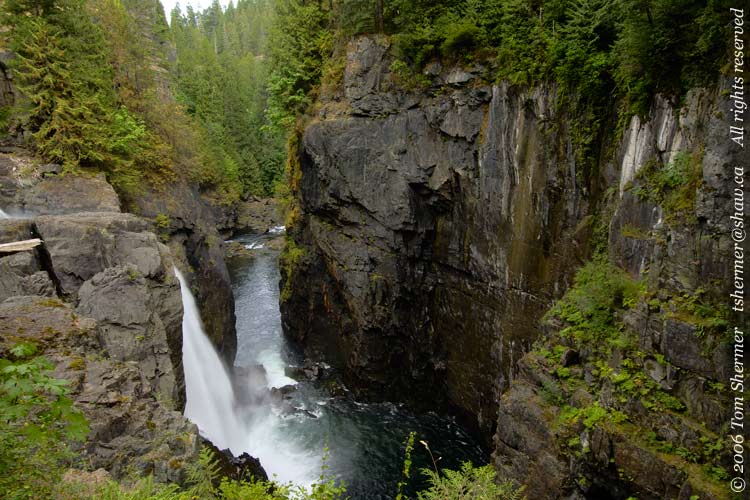 |
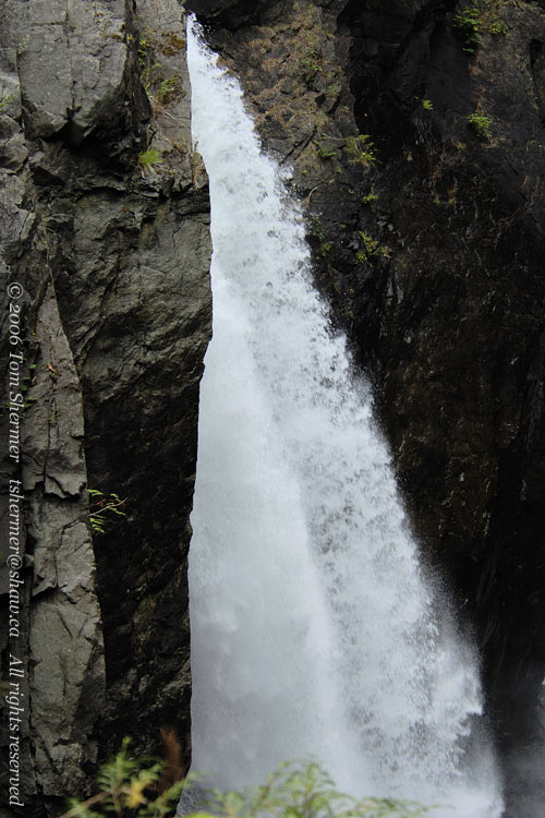
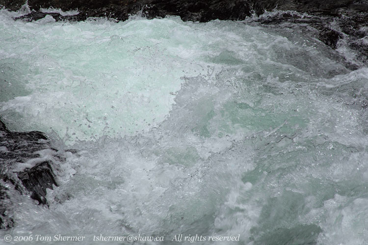
I headed back and investigated some of the other trails nearby. One of them led to the river. In that area, there are a few little signs warning of getting too close, but otherwise you can walk right down the (sometimes slippery) rock to the river's edge. And the river was confined to a smallish strip and was moving very fast. In this photo, where you stop seeing the river is where it is plunging over the falls. |
|
 |
Even a large human like myself would probably not be able to avoid being swept over the edge if they fell in the river here. It would be foolish to get too close...this is a park that Darwin would have loved.
Naturally, I couldn't resist. |
|
 |
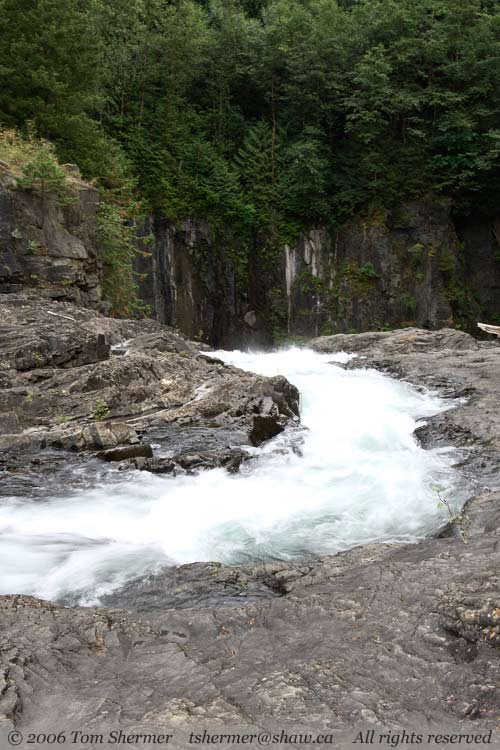
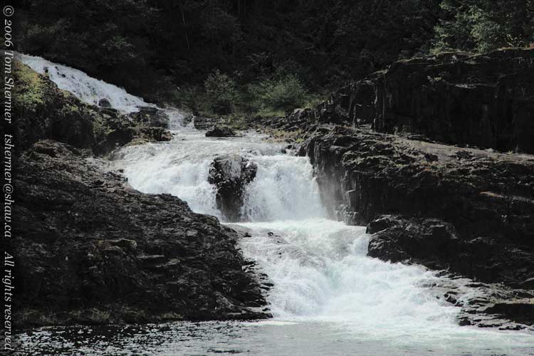
| Venturing further upriver, I found that there are two falls at Elk Falls; the upper one is more of a pretty cascade than a sheer drop. |
|
 |
I decided not to walk around the lake to get close to the upper falls, as I didn't know how much more driving I had to do this day. I headed back up the hill to my car, slightly disappointed at having found neither fallen nor upright elk.
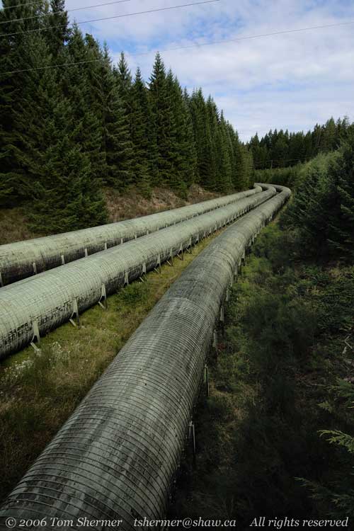
Now, just before entering the parking lot, I had crossed a bridge that went over some honkin' big pipes, and I wanted to get photos of them, so I drove up to the top of the lot and parked there beside the road. Then I went out on the bridge and shot the pipe. |
|
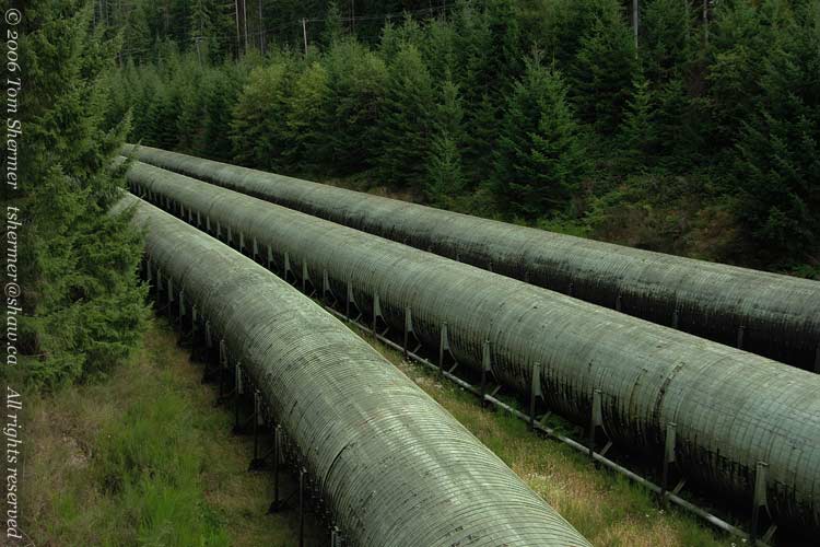 |
| These pipes take water from the John Hart Lake (about 40 meters to one side of the bridge) down to the power generating station that I had encountered earlier. |
|
 |
It was almost surreal; I felt like I had landed in a science fiction movie or something, and I was seeing the grimy infrastructure being the gleaming city of the future.
|
|
 |
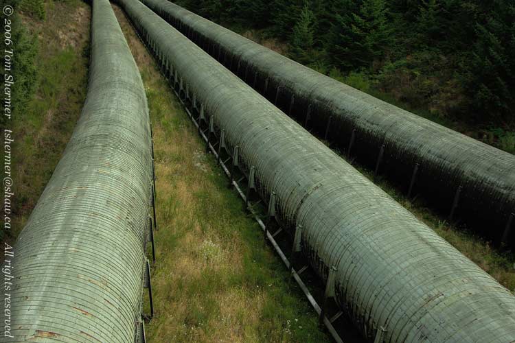
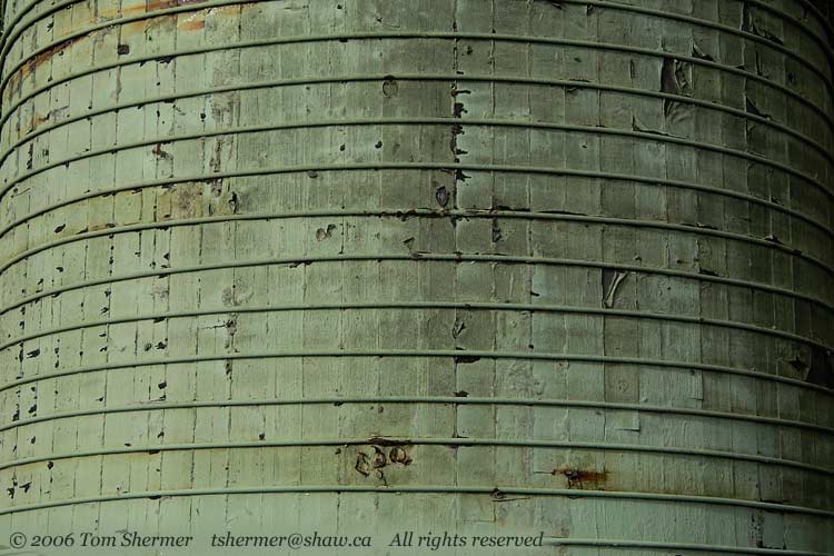
| Here's the detail of one of the pipes as it passes under the bridge I was on. |
|
 |
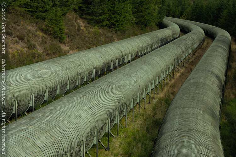
| Here's a final shot of the pipes, with a bit of a wider angle, and a bit more sunlight. |
|
 |
The pipes were awesome, but I also wondered what the falls would be like if all the water in the pipes had been going that way. The pipes must be moving a lot of water.
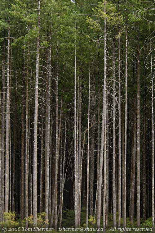
As I got back to the park entrance, I was taken with the woods on the side of the road opposite me. There were lots of tall evergreens there, but only the tops of them had any needles. These tall, straight trees are Lodgepole Pine. It was nice to have a clear view to such a tall stand of them. |
|
 |
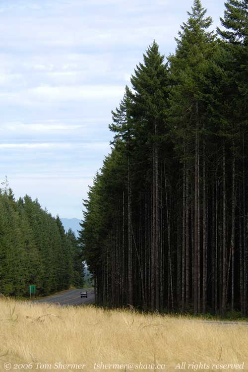
| Here's another view of the area, showing the way I was about to drive. |
|
 |
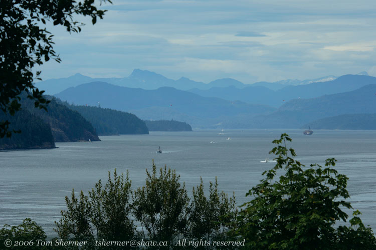
Back on the road leading up the island, my next stop was at a roadside marker for the Seymour Narrows. The Seymour Narrows was once considered the most treacherous marine navigation channel in North America; it's a narrow channel that has opposing wind and current. Both the winds and the tidal currents there are very strong (a whole lot of water has to move a long distance around Vancouver Island for the tides to change) and it results in whirlpools, eddies, and standing and other abnormally large waves. It's the kind of stuff that makes a sailor curse. (And I'm not talking about everyday good-natured sailor cursing. I'm talking about fear-and-despise-it-down-in-the-marrow sailor cursing.)
But that's today, and today the narrows is a pussycat compared to what it once was. Captain George Vancouver, a man who we've named many things after, once described the Seymour Narrows as "one of the vilest stretches of water in the world." And he'd seen a lot of the stretches of water of the world, being a captain and an explorer and all that.
In 1958, Canada made a big bang by blowing up the worst obstacle in the narrows, Ripple Rock. (Literally, it was a big bang...over 1300 tons of explosives, the largest intentional non-nuclear explosion of its day.) Ripple Rock was a double-fanged underwater peak that could come up to within about 3 meters of the surface. Between 1875 and 1958, Ripple Rock sunk 120 ships and took 114 lives. Since 1958, well, there is no Ripple Rock, but the Narrows does still occasionally take ships and lives.
Anyhow, here's the view out over the north end of the narrows. The water in the bottom of the photo is part of the narrows proper, which extends to the right. Unfortunately, trees blocked the view of the narrowest part of the channel. |
|
 |
|
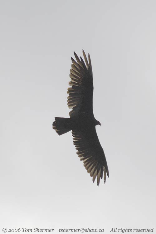
My goal for the day was Port McNeill, the next-to-last town on the road north. I had motel reservations for a few days there. Unfortunately, between Campbell River and Port McNeill, the road is inland, and so I didn't see any other neat coastal stuff. About the only thing I encountered the rest of the way was an occasional Turkey Vulture gliding over the road. |
|
 |
|
And so that was pretty much all for my Day of Driving North. I did set up an interesting tour for the next day, but that'll have to wait for the next entry (or two, or three).
Elkless in Port McNeill,
Tom
|
|
|